New Framework Reimagines the Robert F. Kennedy Campus as a Mixed-Use Waterfront District
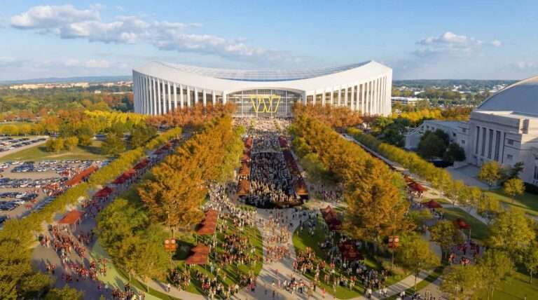
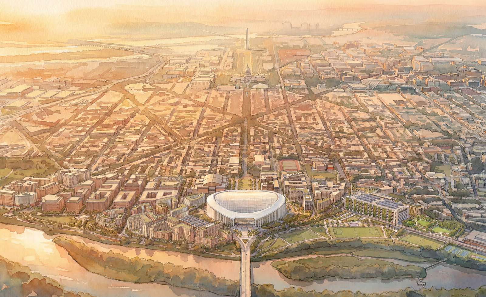
The District of Columbia recently released a comprehensive masterplan for the 180-acre Robert F. Kennedy Campus. The proposal transforms the former stadium site into a dense, mixed-use neighborhood anchored by a new professional football stadium and expansive public parkland along the Anacostia River. This urban framework seeks to reconnect the capital city’s ceremonial axis with its eastern waterfront through housing, retail, and transit-oriented architecture.
The design replaces the footprint of the now-demolished memorial stadium with a multi-layered district. The scheme calls for the construction of between 5,500 and 6,500 new housing units. The plan mandates that 30 percent of these units remain affordable to address local housing needs. To support this density, the team included 6,000 parking spaces within garage structures to keep the street-level experience focused on pedestrians.
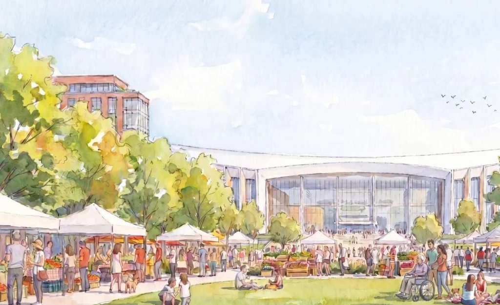
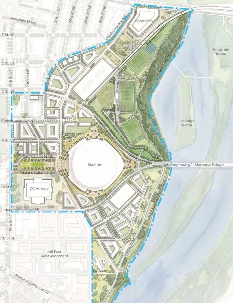
Six distinct character zones organize the campus: the stadium, plaza, riverfront, and recreation districts, alongside the Kingman and Anacostia Commons. The stadium serves as the primary anchor for the entertainment district. It features a generous entry plaza designed for flexible use, including concessions and public gatherings. Surrounding development blocks will maintain heights of 110 feet, while the stadium itself will reach a maximum height of 130 feet to comply with local height regulations.
Waterfront Restoration and Public Realm Connectivity
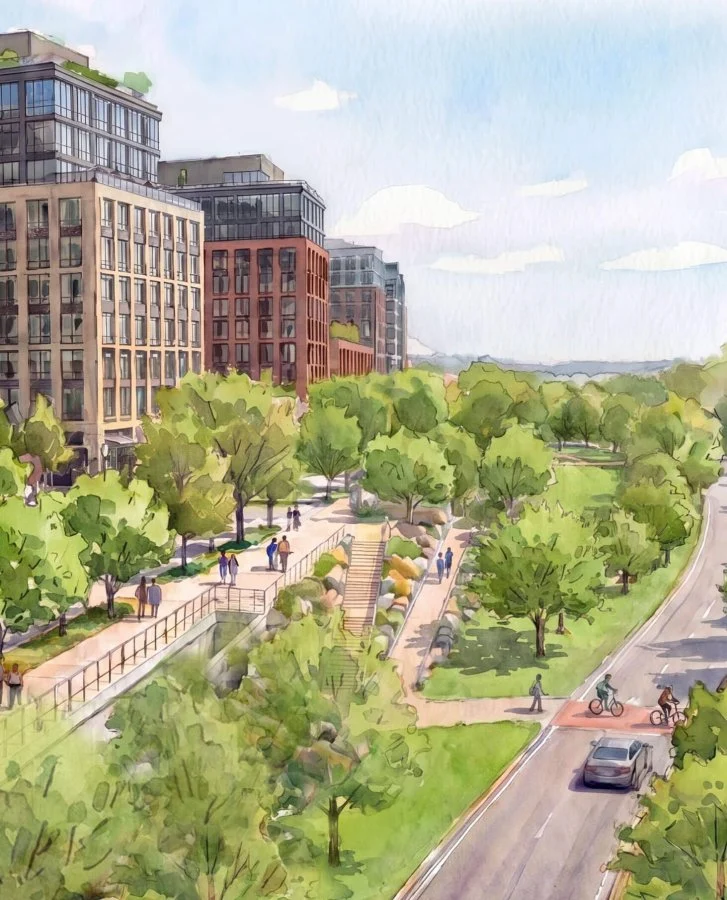
The plan dedicates 30 percent of the total site area to public greenery and open space. A 200-foot-wide building-free buffer, known as the Anacostia Commons, will hug the riverbank to restore the natural riparian zone—the sensitive interface between land and a river. This ecological strip ensures environmental resilience while providing residents with walking and cycling trails. The recreation district further expands this public offering with athletic fields and a new community SportsPlex.
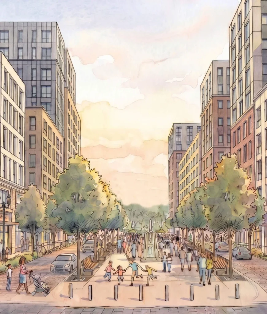
A primary north-south spine, 22nd Street, reorganizes the cities local transit logic. This multimodal corridor includes a dedicated bus lane, two lanes for vehicular traffic, and a protected cycling path. The sidewalks along this spine will feature active ground-floor retail and neighborhood-centered services. This infrastructure aims to improve safety and connectivity for the historic communities adjacent to the campus that previously faced geographic isolation from the riverfront.
The planning process incorporated input from nearly 1,800 participants over 33 community events. By analyzing disaggregated data, the team addressed historic disparities in housing access and transportation. The framework intends to foster economic benefits for local residents through strategic investments in the public realm. The proposal now enters a public comment period before moving toward final submission to federal authorities in late 2026.
Circulation Hierarchy and Programmatic Intelligence
The project demonstrates a sophisticated understanding of programmatic zoning by balancing the high-impact needs of a sports venue with the granular requirements of a residential neighborhood. By concentrating the stadium and entertainment districts near the existing transit infrastructure and primary plaza, the design mitigates the disruptive surge of event-day crowds. The transition from the dense urban spine of 22nd Street to the porous, building-free riparian zone at the water’s edge establishes a clear hierarchy of privacy and activity. This spatial sequencing utilizes the large-scale recreational fields as a programmatic buffer, protecting the quietude of the residential blocks while maintaining visual and physical permeability toward the Anacostia River.
✦ ArchUp Editorial Insight
The framework presents a compelling model for reclaiming vast, underutilized urban voids by weaving monumental sports infrastructure into the permanent fabric of a residential neighborhood. By utilizing a 200-foot riparian buffer and prioritizing multimodal construction along the 22nd Street spine, the project successfully bridges the gap between the city’s historic core and its eastern waterfront. This approach utilizes density as a tool for ecological restoration and social connectivity. However, the reliance on a 130-foot stadium anchor as the primary economic engine introduces a precarious mono-functional risk. While the plan promises neighborhood integration, the sheer scale of a professional sports venue often overwhelms local street life, potentially turning the “vibrant” plazas into sterile, oversized concrete aprons during the long periods between events. Balancing these disparate scales remains the project’s most significant hurdle for long-term sustainability.
Project Team: Gensler, Perkins Eastman, HKS, and OJB. Location: Washington D.C., USA.
Project Notes: The District of Columbia Office of Planning released the masterplan in July 2026. The team expects to submit the final plan to the National Capital Planning Commission in September 2026 for approval.