Dubai Launches Comprehensive Digital Twin to Map Urban Infrastructure

Dubai Launches Comprehensive Digital Twin to Map Urban Infrastructure
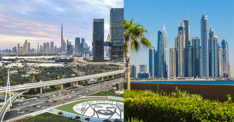
Dubai recently launched a massive digital twin project that creates a precise virtual replica of the city’s entire physical environment. This digital model includes 3D representations of more than 195,000 buildings and 280,000 infrastructure assets. The initiative aims to improve urban planning and simulate future environmental scenarios to enhance the city’s overall quality of life.
The system integrates 1,500 geospatial data layers, which provide specific geographical information about the city’s landmarks and residential units. It also features over 100 applications that allow different sectors to access two and three-dimensional data. This technical framework allows the city to manage assets with greater precision by centralizing information that previously existed in separate departments.
The project focuses on future-proofing the city against environmental and logistical challenges. During a recent demonstration, the team showcased how the model simulates heavy rainfall to predict potential flooding. By testing these scenarios in a virtual environment, officials can design better drainage systems and emergency responses before construction begins in the physical world.
Strategic Integration of Urban and Geospatial Data
The platform unifies spatial and operational data into a single interface. This means that planners can see both the physical shape of a building and its real-time performance data simultaneously. The intervention supports more efficient decision-making by providing a comprehensive digital environment where various agencies can collaborate on construction and maintenance schedules.
The next phase of the project involves expanding these capabilities across asset management and infrastructure operations. The team signed new agreements to integrate private sector expertise into the platform. This expansion will allow for more granular mapping of master plans and utility networks, ensuring that every layer of the city remains visible to decision-makers.
By leveraging these advanced technologies, the city intends to elevate its standards for sustainability and resilience. The digital twin acts as a living document that evolves as the city grows. It ensures that new developments fit into the existing urban fabric while minimizing disruptions to public services during the building process.
Data Granularity and Predictive Urban Modeling
The project represents a shift toward data-driven urbanism where the building is no longer an isolated object but a node in a vast digital network. By mapping 330,000 public facilities, the team creates a circulation hierarchy that reveals how people and resources move through the city. The use of geospatial data layers—information tied to specific map coordinates—enables a level of structural and logistical analysis that static plans cannot provide. This approach allows for the simulation of complex urban events, such as traffic surges or utility failures, providing a technical foundation for high-performance city management and programmatic intelligence.
✦ ArchUp Editorial Insight
The implementation of a city-wide digital twin represents a significant leap toward predictive architecture and planning. By centralizing 1,500 data layers, the project transforms the city into a searchable database, allowing for a rigorous analysis of spatial efficiency and environmental resilience. This digital framework provides the necessary tools to simulate climate impacts like rainfall before they occur in reality. However, this total digital visibility introduces a tension between administrative efficiency and the organic complexity of urban life. While the model excels at managing physical construction and infrastructure, it risks reducing the city to a series of optimized data points. A perfectly simulated environment might overlook the informal, unmapped social interactions that define a vibrant public realm, prioritizing technical performance over human unpredictability.
Project Team: Dubai Municipality, Al-Futtaim Group, Huawei. Location: Dubai, United Arab Emirates.
Project Notes: Status is active and expanding. The team launched the platform in July 2024. Next phases involve broader private sector integration for asset management.