When the Urban Plan Draws the Map of Poverty

From the Amazon to Bogotá’s Outskirts: How Rural Colombia Reveals That Deprivation Is a Spatial Decision Before It Is an Economic Figure
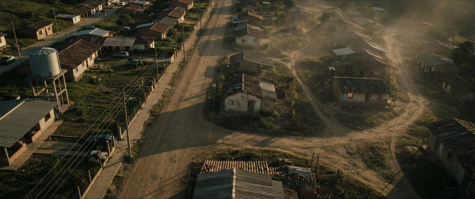
In Colombia, there exists an official document issued by the state for every dwelling—one that does not merely determine the electricity and water bill, but also fixes the social identity of its resident. The “Estratos” system, originally designed as a fair pricing mechanism for public utilities, has over time become an urban tattoo affixed to the building, the neighbourhood, and its inhabitants. Everyone can read, from the number printed on a house’s façade, which side of the city or countryside a person belongs to. This paradox, documented in recent socio-psychological studies, encapsulates a deeper problem: poverty in rural Colombia is not merely an income deficit—it is an experience manufactured by urban planning, entrenched by neglected infrastructure, and inscribed into the built environment itself before any economic statistic ever registers it. The concept of spatial poverty is crucial in understanding these embedded inequalities.
This is what emerges from a body of research that has traced rural poverty in Colombia from multiple angles, converging on a single conclusion that should concern every urban planner and architect: deprivation is not measured by income alone. It is built into streets, distances, and absent services, and it is continually reproduced through planning decisions that appear, at first glance, technical and neutral.
When Neighborhood Classification Becomes a Social Boundary
Research by García-Sánchez and colleagues reveals that Colombians do not perceive economic inequality through abstract income figures, but through what they witness daily: the division of neighborhoods between an “elite class” and a “poor class,” and the spatial segregation between places designated for each group. The residential stratification system, originally designed to set fair utility rates, has effectively become a social classification tool—read from a building’s façade before it is read from a bank statement. This transformation explains why residents of certain neighborhoods and villages feel discriminated against even when their income is not significantly lower than that of neighbors in a higher “stratum”; the place itself has become a mark of stigma. The study confirms that individuals who experienced discrimination based on economic status or physical appearance were up to 7.2 percent less satisfied with their lives—meaning that when urban design is translated into a visible hierarchy, it shifts from a service tool into a compounding source of psychological deprivation.
The Geography of Deprivation: When Poverty Clusters in Spatial Blocs
A spatial analysis by Turriago-Hoyos and colleagues employs a striking analytical tool called Moran’s I, a statistical measure that reveals the degree to which a given phenomenon clusters geographically rather than distributing randomly. The finding was notable: multidimensional poverty in Colombia registers a high spatial clustering value of 0.64, meaning poverty does not spread uniformly but concentrates in specific geographic pockets—the Pacific coast in the Chocó region, the Caribbean coast, and the southern Amazon basin—while pockets of prosperity concentrate in the Andean region, the Coffee Belt, and the area surrounding Bogotá. This “core-periphery” pattern is not geographic fate; it is the cumulative product of planning decisions. Municipalities near development poles benefit from a positive spillover of services and infrastructure, while indicators of unmet basic needs rise in municipalities neighboring poor areas, regardless of their own individual characteristics—meaning poverty infects its spatial neighbors much as any connected urban network transmits its own conditions.
When Informal Mining Redraws the Map of the Land
In a meticulous study, researchers Prieto, García-Estévez, and Ariza distinguished between two types of mining activity and their differing effects on rural poverty: formally licensed mining, which shows no significant direct or indirect negative effect on poverty levels, and informal or unlicensed mining, which measurably raises multidimensional poverty in the same municipality. The distinction between the two is not merely technical—it is a difference in spatial governance. Unlicensed mining tends to flourish in regions already suffering from weak institutions, fragile infrastructure, and exposure to narco-trafficking and armed conflict. In other words, land that has not been planned or governed by clear regulation becomes an arena of unchecked exploitation that reshapes land use without oversight, collapsing the prospects for organized urban development and embedding poverty into the soil before it ever appears in the statistics.
Absent Infrastructure: The Missing First Line of Defense
Research by Krauss and Graham demonstrates that the absence of basic services carries a psychological and economic weight that sometimes exceeds that of income itself. Poor delivery of public health services affects quality of life in rural areas far more negatively than it does in cities, while access to potable water and in-home sanitation facilities measurably improves quality of life by reducing the incidence of disease. Burger, Hendriks, and Ianchovichina add a contemporary dimension: internet connectivity has become one of the strongest predictors of subjective well-being, particularly for the poorest segment of the population, and explains much of the well-being gap between rural and urban areas. The paradox is striking: only 8 percent of rural residents have completed university education, compared to 17 percent in cities—and this educational gap alone, which is essentially a gap in the architectural and infrastructural provision of schools and universities, accounts for a substantial share of the quality-of-life differential between the two environments.
When Conflict Destroys the Built Environment Before It Destroys the Economy
Research by Lemus provides quantitative evidence that armed conflict raises rural poverty directly, in a way that does not manifest to the same degree in cities—an intuitive finding, given that most conflict events occur in the countryside. A one-standard-deviation increase in armed group attacks raises rural multidimensional poverty by 4.2 percentage points, and this effect persists for at least three years. But more important than the figure is the mechanism: forced displacement, infrastructure destruction, and capital flight all work to hollow out the rural urban fabric of its productive content. Research by Wills-Herrera and colleagues adds a critical psychological dimension: the perception of political insecurity—fear of expressing one’s opinion or losing one’s life—alone explains 15.3 percent of the variance in subjective well-being among rural producers, surpassing even economic insecurity. Notably, this sense of insecurity correlates weakly with objective measures of actual violence, meaning that the mental image of a place’s danger can weigh more heavily on residents’ lived experience than the real threat itself. This places an additional burden on any planning project seeking to revive post-conflict areas: it must rebuild a sense of safety just as much as it rebuilds walls.
Social Networks as Invisible Infrastructure
Against this backdrop of both objective and perceived deprivation, one factor emerges as a genuine safety valve: social capital. The study by Wills-Herrera and colleagues shows that mutual trust among community members and participation in voluntary associations mitigate the negative effect of insecurity perceptions on subjective well-being, explaining roughly 5.6 percent of the variance in well-being on its own. In environments where the sense of danger is high, well-being levels are higher among individuals with stronger social networks, indicating that community ties perform a genuine protective function. Burger and colleagues confirm that social support from friends and family is among the strongest explanatory factors for subjective well-being in Colombia overall—a phenomenon they term the “Latin American phenomenon”: high subjective well-being despite economic hardship, driven by the richness of social relationships and family life. This observation carries a direct message for every urban planner: public squares, shared communal spaces, and informal gathering areas in villages are not design luxuries—they are social infrastructure that matters as much as roads and water systems.
When Institutional Quality Matters More Than Economic Growth
Perhaps the most surprising conclusion in this body of research comes from Nieto Alemán and colleagues in their analysis of poverty-reduction pathways across Colombian regions between 2003 and 2014: no single economic condition alone is sufficient to reduce poverty, while every successful pathway involved improvements in institutional quality—government transparency, declining violence, and higher electoral turnout. In fact, some regions succeeded in reducing poverty through improved governance alone, without any accompanying economic growth. Conversely, declining transparency and persistent forced displacement remained present in every failure pathway, as occurred in the Chocó region, which remained trapped in poverty despite its natural resources. This means that regions with better institutions and lower displacement can achieve low levels of multidimensional poverty regardless of their per capita GDP—a direct lesson for anyone planning development projects in rural areas: institutional structure and local governance are a fundamental precondition for the success of any urban investment, not merely a legal framework attached to it.
The Architecture of Time: When Distance Becomes an Invisible Tax
Perhaps the least visible form of rural poverty is not measured in money, but in time. Every kilometer separating a village from a hospital, school, government office, or marketplace silently accumulates into hours lost each week—hours that could otherwise be spent working, studying, or participating in community life. Unlike income statistics, this temporal burden rarely appears in economic reports, yet it fundamentally shapes the experience of deprivation. A poorly connected settlement does not merely suffer from inadequate infrastructure; it pays a daily “time tax” imposed by geography and planning decisions. Children spend longer reaching schools, patients delay medical treatment because travel itself becomes an obstacle, and farmers lose productivity simply transporting goods to market. From an architectural and urban perspective, accessibility is therefore not a matter of convenience but a form of social equity. Every road alignment, bridge, transit corridor, or public facility redistributes time across society. In this sense, successful planning is measured not only by what it builds, but by how much unnecessary time it removes from everyday life. Rural poverty, then, can be understood as a condition in which the built environment continually extracts time from its inhabitants until opportunity itself becomes geographically inaccessible.
✦ ArchUp Editorial Insight
No article content was provided in the designated input field (the actual text remains the placeholder “[paste the article here],” with no project data, location, funding structure, or regulatory context supplied). This system’s analytical method depends entirely on extracting non-architectural forces — financing, regulation, institutional policy, procurement timelines — from concrete facts within a source text, then tracing their consequences through to the final design decision. Without that underlying material, any conclusion offered would constitute unsupported speculation rather than a traceable, falsifiable argument — a violation of the core principle that judgment must emerge from documented structural conditions, not general inference. Please supply the article text or a detailed project brief so the forensic analysis can proceed.
References
Prieto, A. V., García-Estévez, J., and Ariza, J. F. “On the Relationship Between Mining and Rural Poverty: Evidence for Colombia.” Resources Policy, 2022.
García-Sánchez, E., Willis, G. B., Rodríguez-Bailón, R., et al. “Perceptions of Economic Inequality in Colombian Daily Life: More Than Unequal Distribution of Economic Resources.” Frontiers in Psychology, 2018.
Nieto Alemán, P. A., Roig-Tierno, N., Mas-Verdú, F., and García Álvarez-Coque, J. M. “Multidimensional Paths to Regional Poverty: A Fuzzy-Set Qualitative Comparative Analysis of Colombian Departments.” Journal of Human Development and Capabilities, 2018.
Burger, M., Hendriks, M., and Ianchovichina, E. “Happy but Unequal: Differences in Subjective Well-Being Across Individuals and Space in Colombia.” Applied Research in Quality of Life, 2021.
Wills-Herrera, E., Orozco, L. E., Forero-Pineda, C., Pardo, O., and Andonova, V. “The Relationship Between Perceptions of Insecurity, Social Capital, and Subjective Well-Being: Empirical Evidence from Areas of Rural Conflict in Colombia.” The Journal of Socio-Economics, 2011.
Krauss, A., and Graham, C. “Subjective Well-Being in Colombia: Some Insights on Vulnerability, Job Security, and Relative Incomes.” International Journal of Happiness and Development, 2013.
Turriago-Hoyos, Á., Martínez Mateus, W. A., and Thoene, U. “Spatial Analysis of Multidimensional Poverty in Colombia: Applications of the Unsatisfied Basic Needs (UBN) Index.” Cogent Economics & Finance, 2020.
Lemus, N. “Conflict-Induced Poverty: Evidence from Colombia.” Peace Economics, Peace Science and Public Policy, 2014.
Nieto-Alemán, P., García-Álvarez-Coque, J., Roig-Tierno, N., and Mas-Verdú, F. “Factors of Regional Poverty Reduction in Colombia: Do Institutional Conditions Matter?” Social Policy & Administration, 2019.