The Architecture of Sovereignty and Water: How Floods Redesign Border Cities
On the spatial incongruity between security walls and natural flow paths, and the mechanisms of building back better in politically complex environments.
Throughout history, the engineering of urban space has witnessed fierce confrontations between the political lines drawn on maps and the natural flows of geography. When floods strike border cities, the situation ceases to be a mere drainage crisis searching for a traditional engineering solution; instead, it transforms into a structural dilemma that dismantles the concept of the physical sovereignty of place. Here, architectural design and urban planning transcend their simple technical boundaries to engage directly with issues of national security, transboundary legislation, and the reshaping of sustainable human space. The shocking paradox lies in the fact that infrastructure designed to protect national security can become the primary driver of environmental disasters within the shared urban fabric, presenting architects and planners with the dilemma of dismantling these walls engineering-wise and politically to rebuild more resilient communities.
Spatial Incongruity: When Security Ideology Collides with Natural Hydraulics
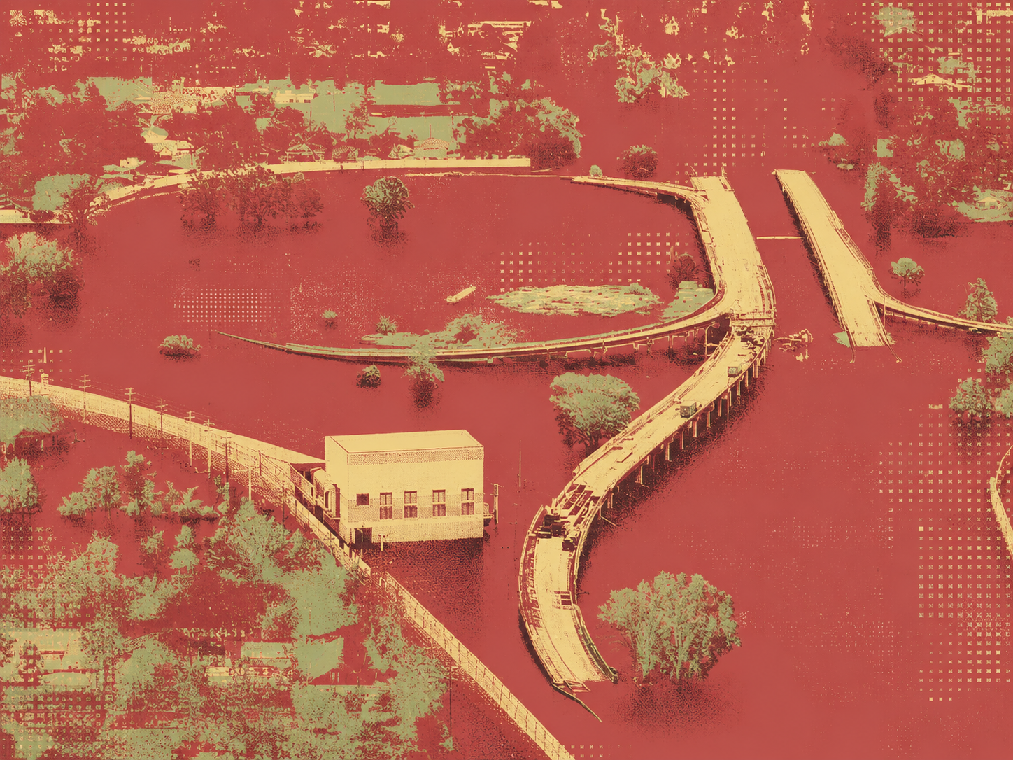
In contemporary planning literature, the term “spatial incongruity” is proposed to explain the conflict arising between the rigidity of solid architectural mass and the dynamism of ecosystems. The twin cities of Nogales, shared between the United States and Mexico, embody this contradiction in its most radical form, where the security border wall has turned into a solid physical barrier intercepting the natural hydraulic paths of the site. According to research documented by C. L. Sorrensen, this design flaw resulted in the retention of water at a height of nearly one and a half meters, leading to the flooding of the commercial fabric on the Mexican side and turning public space into isolated swamps. This is the moment when security infrastructure reveals its planning failure, as the designer treated the border line as a definitive physical boundary, ignoring the absorption capacity of the land’s topography and the fluidity of natural space.
Invisible Walls: Fragmentation of Responsibility and the Conflict of Planning Authorities
The crisis of border cities lies not only in physical obstacles, but in the invisible organizational walls that disrupt urban strategies. Case studies in Nogales point to a sharp gap known as the structural fragmentation of responsibility between sovereign institutions and international water commissions. This organizational dispute consistently overlooks the core factors of the crisis, chief among them unregulated urban sprawl. Along similar lines, researcher M. Wiering, in a comparative study on the rehabilitation of the Dinkel River between the Netherlands and Germany, observed the dilemma of planning separating from implementation. Although both parties succeeded in formulating a joint visual vision and master plans, actual implementation collided with complex local legislative obstacles related to private land ownership and land-use zoning. This proves a well-established planning rule: the broader the ambitions for spatial configuration across borders, the more deep and interconnected institutional frameworks and legislative structures must be.
The Wicked Problem: Divergent Philosophies of Spatial Handling and Risk Levels
The problem transcends design dimensions to reach the philosophy of risk perception and its impact on the articulation of the built environment. In the Rhine basin, a clear methodological divergence exists between the Netherlands, which adopts a strict engineering protection strategy relying on absolute structural defense, and Germany, which leans toward flexible solutions focused on awareness and damage mitigation, based on the analyses of researcher G. Becker. This planning divergence turns disaster management into what urban theory calls a wicked problem. The danger of these dilemmas manifests in the case of the Devils Lake flooding along the US-Canada border analyzed by G. Kharel, where the water and planning dispute escalated into a prolonged international crisis that left one and a half billion dollars in losses, given that design decisions made in these environments are tied to cumulative environmental and spatial consequences that are irreversible.
Resilience Engineering: The Triad of Empowerment and Proactive Building Back Better
To formulate an architectural practice capable of enduring in these complex environments, researcher A. A. Bilau presents a conceptual model consisting of three integrated phases: legislative empowerment, detailed planning, and spatial implementation. This framework intersects with the philosophy of building back better, which anchors the upgrade of built environment resilience through clear structural dimensions.
Structural and non-structural resilience integrates design building code modifications with flexible strategies for urban land regulation. The social absorption of place involves the local community in formulating space to ensure the restoration of spatial identity and return moral value to the affected site. Adaptive environmental sustainability, rather than relying entirely on solid concrete masses, prompts researcher S. D. Guikema to advocate for abandoning traditional design assumptions and dry cost-benefit balances, moving instead toward hybrid infrastructure that employs natural ecosystems—such as mangroves and green buffers—to absorb hydraulic shocks and achieve long-term ecological balance.
Green Spatial Paradiplomacy: Beyond Narrow Engineering Scopes
Addressing water projects in disaster zones requires adopting the Water Resources and Reconstruction (WRR) framework by L. Juran, which views design through the lens of scale multiplicity; a narrow housing unit cannot be isolated from the broader regional plan of the city. From this standpoint, the concept of green paradiplomacy emerged as a flexible planning mechanism allowing local governments and architectural actors to bypass the sovereign bureaucracy of states. The experience of the Great Lakes between America and Canada stands out as a successful example of establishing a unified regulatory framework between eight states and two provinces, grounded in essential success factors: limiting the number of active players, unifying mental and engineering references, and possessing cross-border planning powers that create a safe and cohesive urban environment.
✦ ArchUp Editorial Insight
Flooding in border cities exposes a structural contradiction between hydrological systems and the political economy of sovereignty. Security walls, levees, and checkpoints are financed and procured under national defense logics that prioritize territorial control, rapid delivery, and unilateral liability. Water, by contrast, operates through basin-scale ecologies that ignore jurisdictional lines. The resulting spatial incongruity is not a design error but the predictable outcome of fragmented governance, asymmetric risk philosophies, and incompatible legal regimes. Where one state engineers for absolute protection and another for managed retreat, hydraulic pressure accumulates at the seam. “Building back better” therefore becomes less an architectural upgrade than an institutional negotiation over authority, funding, and land rights. Hybrid landscapes and green buffers appear only when cross-border compacts realign incentives. In this context, architecture materializes as the residue of diplomatic capacity—or its absence.
References
[1] Becker, G., Aerts, J., and Huitema, D. “Transboundary flood management in the Rhine basin: challenges for improved cooperation.” Water Science and Technology, 2007.
[2] Wiering, M., Verwijmeren, J., Lulofs, K., and Feld, C. “Experiences in Regional Cross Border Co-operation in River Management. Comparing Three Cases at the Dutch–German Border.” Water Resources Management, 2010.
[3] Sorrensen, C. L. “A history of transboundary storm water flows: flooding, tunnels, and the spatial incongruity of the U.S.–Mexico border.” Journal of Historical Geography, 2012.
[4] Bilau, A. A., Witt, E., and Lill, I. “A Framework for Managing Post-disaster Housing Reconstruction.” Procedia Economics and Finance, 2015.
[5] Bilau, A. A., Witt, E., and Lill, I. “Practice Framework for the Management of Post-Disaster Housing Reconstruction Programmes.” Sustainability, 2018.
[6] Guikema, S. D. “Infrastructure Design Issues in Disaster-Prone Regions.” Science, 2009.
[7] Juran, L. “A Framework for Integrating Water Projects in Disaster Reconstruction Processes in the International Context.” Public Works Management & Policy, 2015.
[8] Edwards, F. L. “Effective Disaster Response in Cross Border Events.” Journal of Contingencies and Crisis Management, 2009.
[9] Kharel, G., Romsdahl, R., and Kirilenko, A. “Managing the wicked problem of Devils Lake flooding along the US–Canada border.” International Journal of Water Resources Development, 2018.