Transnational Landscape Initiatives Reframe Continental Wildlife Corridors Across Africa and Asia


Two massive reforestation initiatives across the Sahel region and northern China redefine landscape restoration on a continental scale. These continental landscape corridors connect fragmented ecosystems and halt advancing desertification through native planting, dune stabilization, and water management. The dual efforts establish linear ecological buffers that mitigate global climate pressures while protecting agricultural land.
The African initiative establishes an 8,000-kilometer continuous band across the Sahel region. This semi-arid strip stretches from Senegal on the Atlantic coast to Djibouti on the Red Sea. Persistent droughts, soil erosion, and food shortages severely impact local communities across this territory.
The effort originally targeted a continuous belt of trees to block the expanding Sahara Desert. The strategy now combines assisted natural regeneration, agroforestry, and dune stabilization to restore degraded soil. The initiative aims to restore 100 million hectares of land by 2030 while strengthening agricultural productivity and rural livelihoods.

Centralized Systems and Distributed Ecological Networks
The Asian initiative began in 1978 as a long-term environmental restoration plan running through 2050. The program covers approximately 4 million square kilometers across 13 provincial-level regions surrounding the Gobi Desert. Instead of a single forest belt, the network integrates restored forests, grasslands, and protective shelterbelts — linear rows of trees that block wind and protect soil.
The project currently operates in its sixth implementation phase running from 2021 through 2030. Updated planning prioritizes native vegetation, precise ecological monitoring, and regional landscape management within cities and rural regions alike. While the Asian model relies on a uniform physical infrastructure managed through central planning, the African model operates as a flexible mosaic of community-driven projects.

Expanding Rewilding Strategies Across Global Urban Regions
Similar ecological priorities drive urban rewilding and master planning across Europe and North America. Recent waterfront projects in Toronto convert industrial land into resilient public landscapes that reconnect local hydrology. In Paris, public parks incorporate urban farms and restored habitats to adapt urban green spaces to climate shifts.
Meanwhile, brownfield developments transform former rail yards in Budapest into integrated green infrastructure networks through ecological construction practices. These parallel projects show how large-scale landscape thinking influences urban design at every scale.
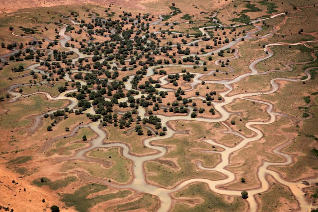
Both continental programs address severe environmental hurdles, including limited water supplies, fragile plantation survival, and soil degradation. Technical teams apply water-harvesting basins — shallow trenches that capture rainwater runoff — to support young trees in arid zones. Local managers select drought-tolerant native species to reduce maintenance demands and build long-term landscape resilience.
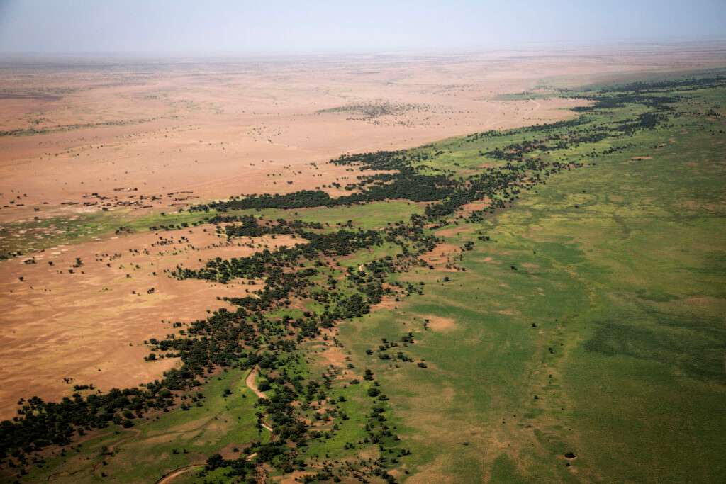
Ecological Scale and Spatial Management
These massive projects transform traditional environmental conservation into dynamic, territorial-scale infrastructure. By shifting from static physical walls to interconnected ecological corridors, the design strategies accommodate natural climate shifts and wildlife migration. The African model relies on localized, decentralized agricultural nodes that adapt organically to territorial variations. Conversely, the Asian model enforces a top-down, geometric grid of protective shelterbelts that systematically stabilizes soil across vast desert perimeters. Both methodologies demonstrate how large-scale spatial planning can mitigate environmental degradation. However, long-term success depends entirely on maintaining water balances and integrating local agricultural economies into the broader ecological framework.
✦ ArchUp Editorial Insight
These continental initiatives successfully redefine landscape restoration by treating ecology as active spatial infrastructure rather than passive conservation. By integrating rewilding corridors across multi-state boundaries, the projects demonstrate how large-scale spatial management creates resilient environmental buffers and supports regional sustainability. The strategic transition from monolithic tree barriers to responsive agroforestry networks reflects a sophisticated understanding of ecosystem dynamics. However, these ambitious environmental frameworks often clash with the economic realities of local land use. Monoculture planting risks depleting fragile groundwater reserves, while top-down administrative mandates frequently override traditional local farming practices. Without sustained community governance and long-term financial backing, these green belts risk devolving into fragmented patches of dead vegetation. Ultimately, continental scale cannot substitute for fine-grained resource stewardship in fragile dryland environments.
Project Team: African Union, Chinese Government, national environmental agencies, international civil society organizations, local communities. Additional urban master planning teams include SLA, Coldefy, CITYFÖRSTER, Sporaarchitects, TREIBHAUS.LAND, Marko & Placemakers. Location: Sahel Region (Senegal to Djibouti, Africa); Three-North Region (Gobi Desert, China); Toronto, Paris, Budapest.
Project Notes: African Great Green Wall targets 100 million hectares by 2030. Chinese Three-North Shelterbelt Program operates through 2050 in six implementation phases. Additional comparative rewilding projects operate under municipal and regional development contracts.