Ripples Become Everyday Ground: Reframing the Embankment

Turning the Protective Wall into Undulating Terrain
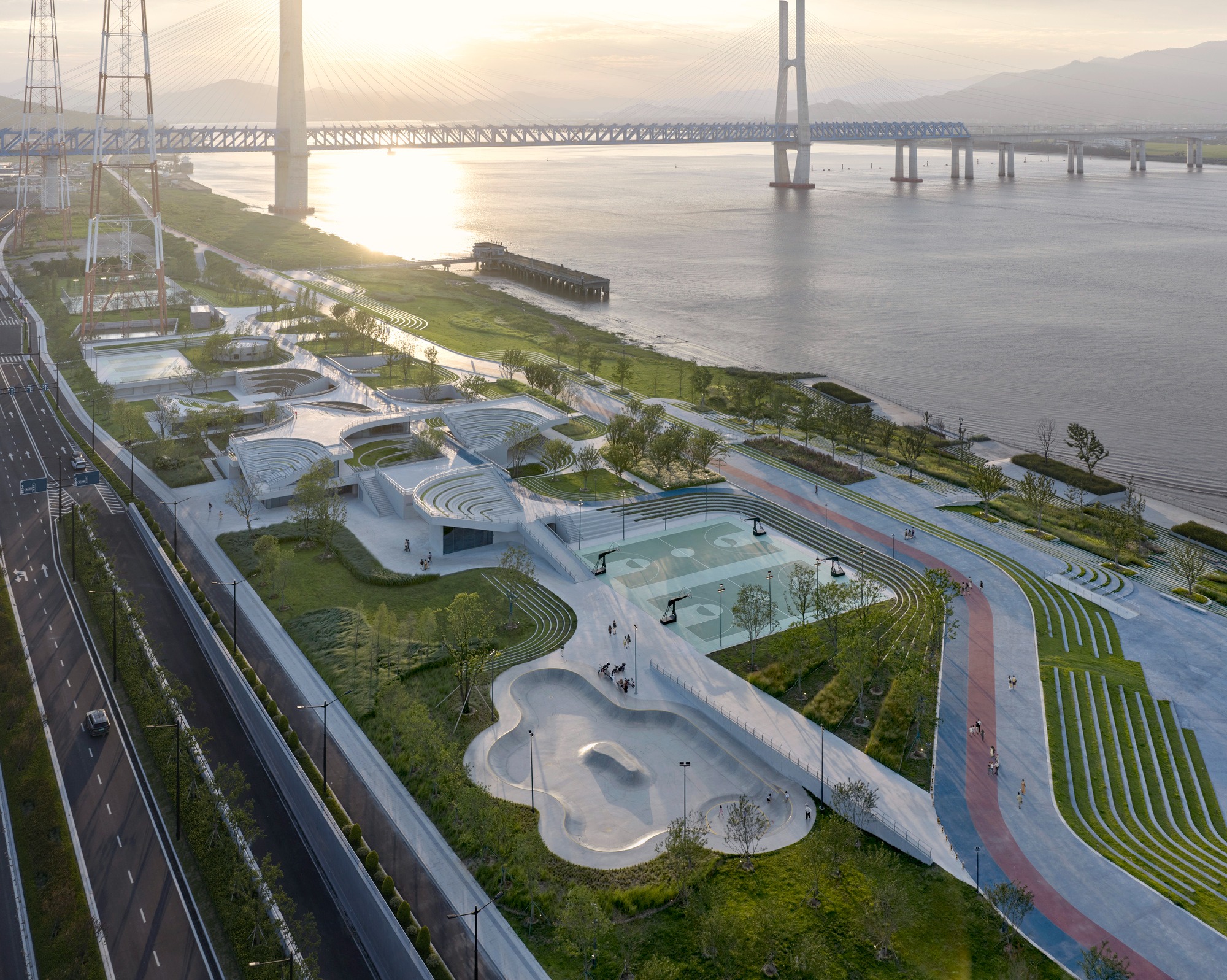
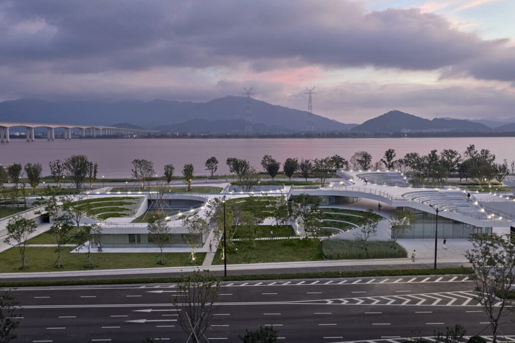
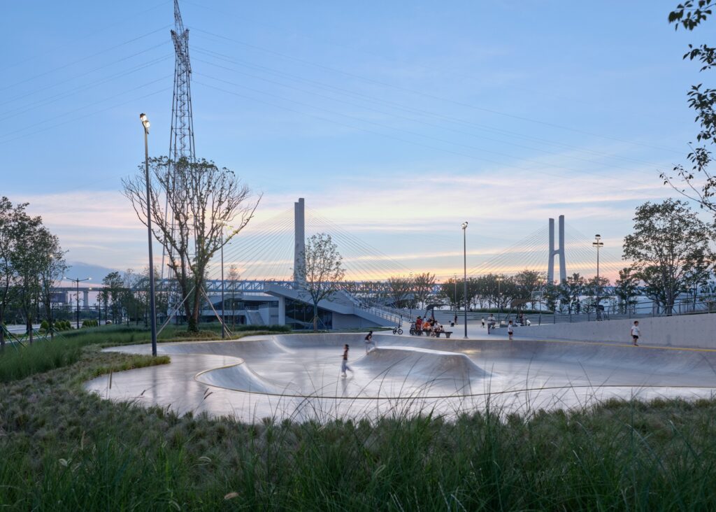
The architectural concept of the project is based on reframing the rigid concrete protection infrastructure and transforming it into undulating green terrain extending from the river’s edge toward the city. This transformation responds to the industrial decline of the Jiaojian River waterfront area, integrating urban activities into a system of blue, green, and gray infrastructure. The project addresses the abandoned industrial site through ecological restoration based on gentle mounds, giving the site a character that is more integrated with the surrounding landscape while enhancing its visual presence when viewed from the nearby Hangzhou–Taizhou high-speed railway bridge. In this way, the project combines flood protection with the reshaping of the riverfront as part of the urban realm.
Dismantling Spatial Barriers: Crossing and Vertical Connectivity
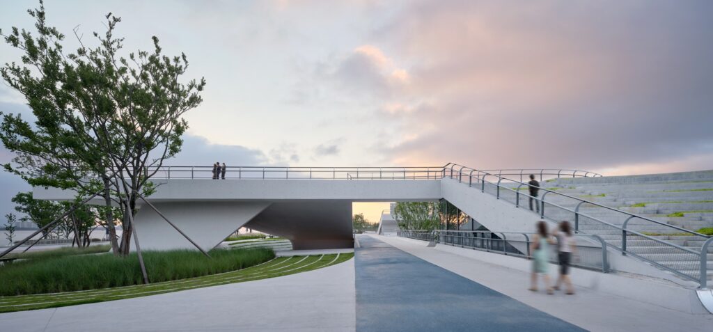
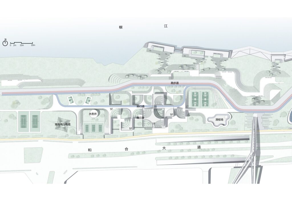
The project’s circulation system addresses the spatial discontinuity created by the embankment structure, the surrounding neighborhood, and the highway network. The pedestrian route begins at a passage along Hehe Street beneath the highway, then gradually moves through a sequence of spaces incorporating an elevated bridge, ground-level paths, and stairs connected to the surrounding terrain. This organization allows for a gradual transition from the more enclosed lower areas to spaces that are more open toward the riverbank, reconnecting the public realm with the water’s edge.
Reframing Vertical Space: A Multi-Level Promenade
The architectural system addresses the 2.4-meter elevation difference between the earth embankment and Hehe Street by organizing circulation levels and connecting them to the roof slab at ground level. This creates a continuous system for movement and strolling that includes a public promenade at ground level and an elevated bicycle path on the second level. Sports facilities, a civic rest station, flood-management offices, sunken courtyards, and viewing terraces are distributed throughout this system, allowing service functions to overlap with the site’s everyday uses.
Visual Exposure and Connection to the Riverfront Realm
The project redirects circulation and sightlines toward the river, with sections of the bicycle path rising to run parallel to the crest of the earth embankment, while viewing terraces provide elevated vantage points overlooking the river landscape from different levels. This sequence gradually carries users from the urban fabric toward open platforms while maintaining visual connections between both sides of the site. The low-rise end façades also help reduce the embankment’s presence as a dominant visual element, connecting the infrastructure with the surrounding natural landscape.
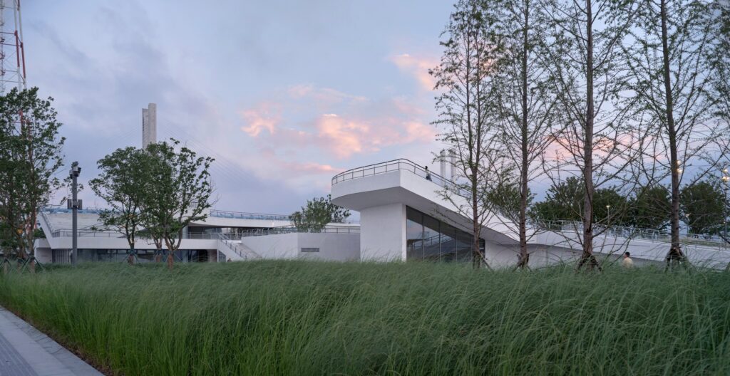
Transforming the Embankment into a Terraced Landscape Park
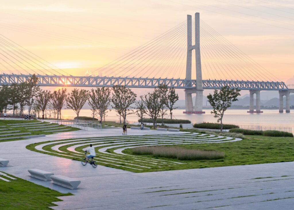
The design approaches the embankment as part of the overall landscape by replacing rigid concrete cladding with stepped grass slopes, stone stepping paths, and low-rise terraces. This treatment introduces new terrain that intertwines with the embankment structure, transforming part of it into a riverside grass park and an open space for strolling, sitting, and observing the landscape extending along the river.
Material Scenography: Light and Concrete Mass
The material treatment of the station is embodied in the double-height central hall, which is anchored by an exposed-finish concrete wall with an arched configuration. A sloping concrete roof spans the hall, allowing natural light to enter and disperse throughout the space, causing the shadows to shift with the movement of the sun throughout the day. The exhibition hall is also enclosed by a double-layered wall that enables the creation of large, column-free spans, while the inclined wall on the northern side forms a more contained outdoor gathering space.
Transforming Industrial Land into a Natural Landscape and Sunset Space
The former industrial courtyard, covered in brown gravel, has been reshaped into a natural landscape that integrates with the terrain of the riverbank. This transformation helps merge traces of the site’s former industrial use with the new landscape, making the water’s edge part of the site’s everyday experience. The sunset park provides Taizhou residents with an open space for pausing, strolling, and observing the river, while maintaining the connection between the site’s industrial memory and the restored natural landscape.
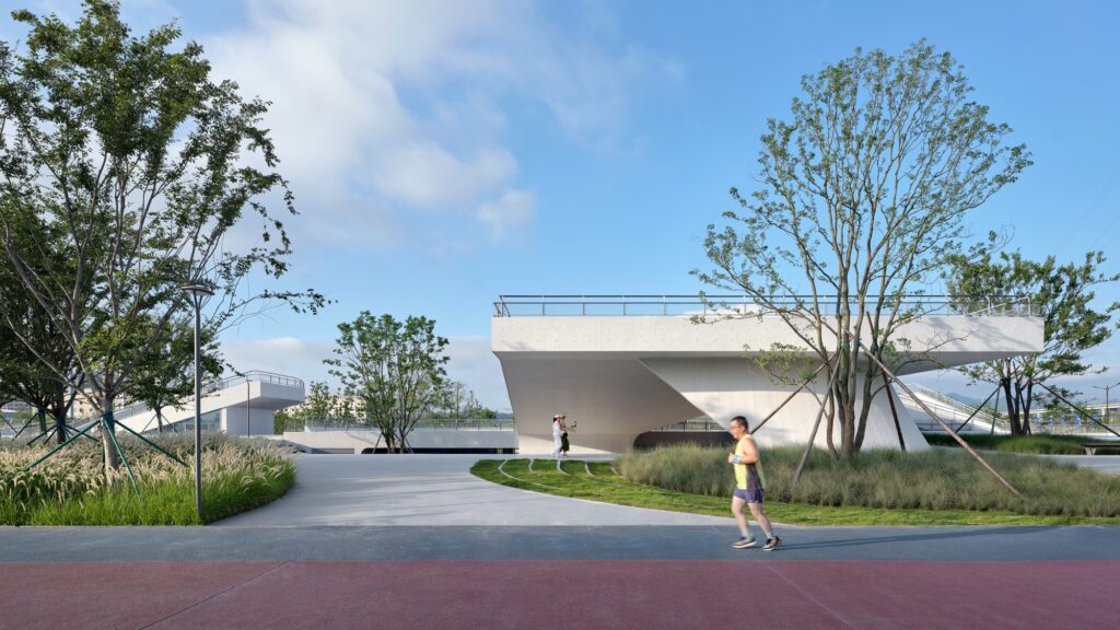
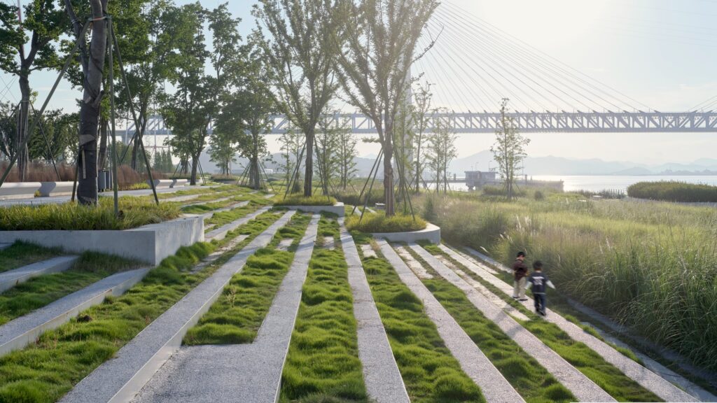
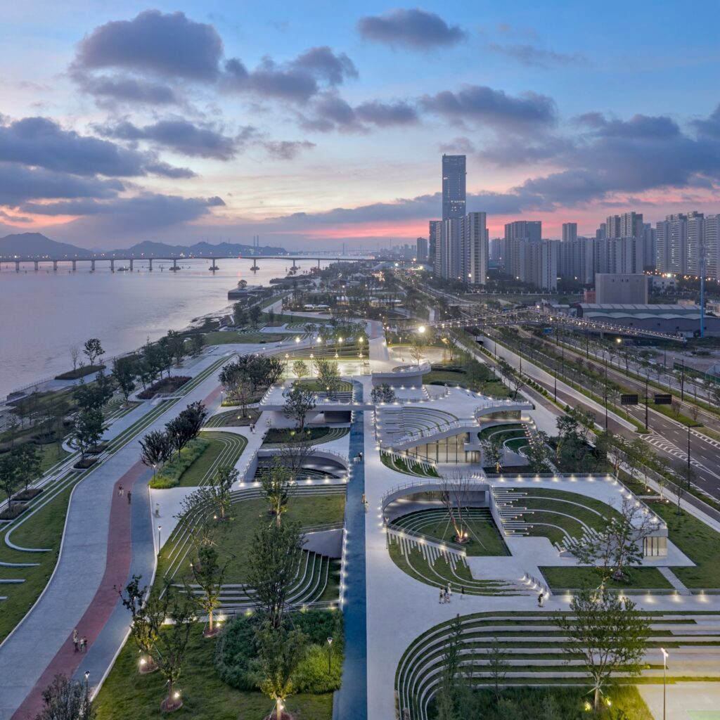
✦ ArchUp Editorial Insight
The project redefines flood-protection infrastructure as a sectional urban tool rather than merely a defensive boundary. The undulating terrain accommodates the former industrial courtyard, reconnects fragmented pedestrian routes, and distributes changes in elevation through a system of public uses. By integrating flood protection with the natural landscape and civic movement, architecture becomes a mediator between the river environment and the redevelopment of the urban fabric.
Yet this integration may transform the infrastructure into an aesthetic landscape that conceals its essential hydraulic function. Grass slopes, elevated bicycle paths, and sunset spaces visually soften the presence of risk without eliminating it. Therefore, the project’s success does not depend solely on its visual integration, but on its ability to maintain these spaces during floods, maintenance cycles, changing river conditions, and municipal budget pressures. The project’s most important elements may ultimately remain buried within the terrain itself.