The Pavement Fits a Person. Does It Fit a Family?


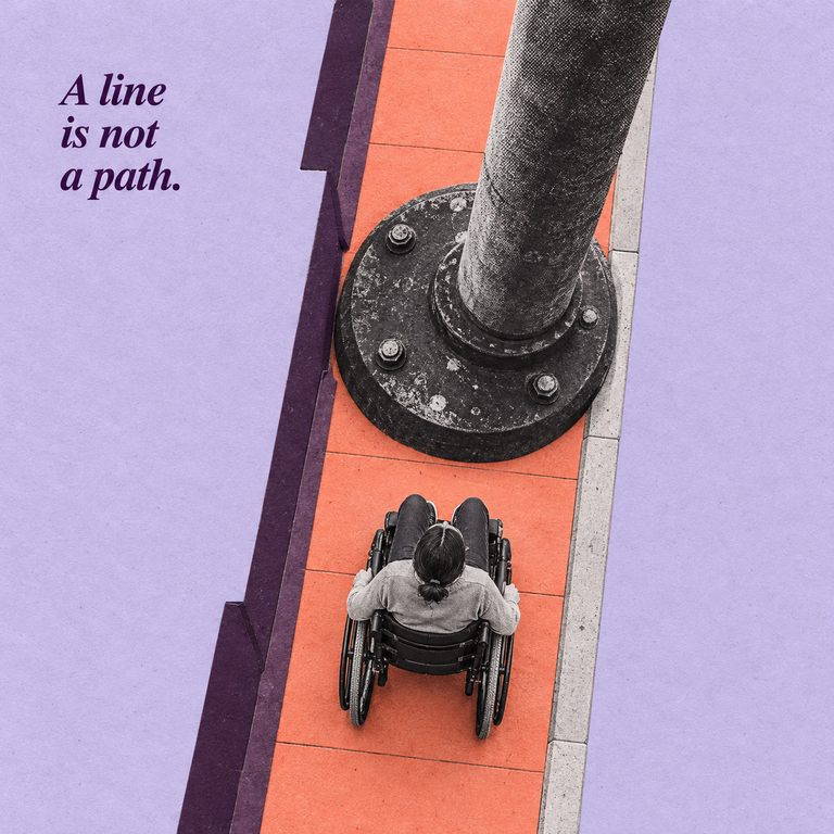
Idea, editorial direction and field observation: Ibrahim Fawakherji. Research development and analysis: the ArchUp research team. The original photograph was provided by Ibrahim Fawakherji. The cover was prepared by the ArchUp visual arts team using AI and is an illustration, not documentary evidence.
A pink stroller stands near the edge of a pavement. People occupy the space around it, and a black pole interrupts the apparent openness of the surface. The photograph is ordinary enough to escape attention. Its architectural question is less ordinary: which moving body was imagined when this pavement was drawn, and which relationships were omitted?
The image shows a spatial arrangement, not a measured flow. It cannot establish walking speeds, the direction of travel, the duration of a gathering or the existence of a recurring bottleneck. Nor does it tell us whether the people form one family. Its value is as the beginning of an investigation. A route may contain enough paving for a person to pass while failing to accommodate a parent beside a child, a companion beside a wheelchair user, or two people meeting without either moving into the road.

The pedestrian in the drawing is an incomplete brief
A single outline is convenient for checking a passage. It has no companion, no shopping bag, no hesitation and no need to turn towards someone. The problem emerges when that checking device becomes the entire account of public use. A family is not merely several unrelated outlines occupying adjacent positions. Its members may need to remain within sight, exchange information, hold hands or coordinate a change of direction. These are reasonable design scenarios, not claims about the unidentified people in the photograph.
Designing for these relationships does not require assuming that every group must always walk abreast. It requires asking what the environment demands when a group changes formation. Is there room to slow down? Can someone wait without blocking an entrance? Can a child remain on the protected side of an adult? Can companions reunite beyond a narrow point? A route that depends on repeated separation transfers an unresolved spatial problem to its users. The pavement remains physically present, but the experience of using it becomes a sequence of negotiations.
Width belongs to a route, not a coloured strip
For this analysis, nominal width means the distance represented by the paved strip. Clear width means the unobstructed passage at a particular location. Usable width is the more demanding design question: what portion of that passage can a particular person comfortably and safely use under the conditions being examined? These definitions are analytical tools here, not substitutes for the applicable local standard.
The distinction becomes visible around a pole. Measuring the paving on both sides and adding the two numbers would describe surface area but not necessarily a continuous route. A person cannot divide their body between disconnected gaps. Nor can a stroller be assumed to rotate instantly at every obstruction. The sequence of approach, passage and departure matters. Two individually passable gaps can form a difficult route when they are offset and leave inadequate space to turn between them.
A research synthesis reports that Coppola and Marshall examined how static obstructions change sidewalk clear width. That supports treating mapped pavement and available passage as different observations, without transferring a numerical result from their study to this photograph. [1]
A bottleneck is a condition that develops in time
A narrow place and a bottleneck are related but different observations. Narrowness can be measured in a plan. A bottleneck requires evidence about movement through time. A short constrained section might operate acceptably at one moment and produce repeated yielding when opposing streams arrive together. A wider section may become difficult when a queue grows across it. The important question is not simply how many people appear in one frame, but what happens before and after that frame.
Consider a hypothetical shop entrance beside a transit stop. People arriving from a vehicle meet customers leaving the shop while others wait for a collection. Each activity is ordinary. Their coincidence creates the design problem. Moving the waiting position or changing the relationship between entrance and through route might address the conflict more directly than widening a distant section. This is a proposition to test at a real site, not a result demonstrated by the supplied image.
Observation therefore needs a sequence: arrivals, pauses, overtaking, yielding and recovery. A useful record asks whether people can regain a comfortable formation after passing the constraint. Counting only those who successfully squeeze through rewards endurance while overlooking inconvenience.
People with mobility needs are part of the public
A wheelchair user is not a piece of street furniture. A stroller is not evidence that a parent is using excessive space. Describing these users as obstructions reverses the responsibility of design. The fixed arrangement should be assessed against the range of people entitled to use it. When passage is difficult, the question is which spatial or operational decision produced that difficulty.
The research synthesis identifies Prescott and colleagues’ review of factors affecting journeys made on foot or with mobility devices. Its relevance is the need to examine the complete journey, rather than infer accessibility from the presence of a pavement. [2]
Our design implication is to follow a route from origin to destination. A generous segment offers little independence if its connection to the next segment requires an unavailable crossing or an awkward turn. Companionship also belongs in that assessment. A person may choose to travel with another person for conversation, orientation or practical assistance. The design brief should allow that choice without treating it as evidence of dependence or assuming that every wheelchair user needs help.
The same object can serve or interrupt public life
Removing everything from a pavement would produce a poor version of accessibility. Seats provide opportunities to rest. Trees can make waiting more tolerable. Lighting supports orientation. A sign can help a visitor understand the route. The task is to arrange these provisions so that one public benefit does not silently consume another. A bench should have space for its users, including someone who remains in a wheelchair, as well as space for movement past it.
Object recognition alone cannot make this judgement. Gharani and Karimi’s work, as described in the reviewed synthesis, connects obstacle detection to a visually impaired user’s navigation context. Recognising an object and determining whether it impedes a particular journey are separate tasks. [3]
For an urban design team, that distinction changes the survey. A furniture inventory should be accompanied by a route drawing showing how objects are approached and passed. A pole that looks tidy when aligned with a facade may be poorly placed relative to a doorway. Conversely, an object visible in a photograph may sit outside the through route. The scene must be read relationally before responsibility is assigned.
The family is a test of coordination
A family provides a useful design test because its members may have different preferred speeds, attention patterns and reasons to pause. It should not become a stereotype. Children differ, adults differ, and families do not share a fixed formation. A meaningful test therefore presents several possibilities: an adult alongside a child, one adult pushing a stroller while another walks nearby, or a group pausing to decide where to go.
These scenarios reveal different needs. A passage wide enough for forward travel may offer little room for a turn. An entrance may admit the stroller while separating the person accompanying it from the rest of the group. A crossing may provide an adequate waiting area until a shop queue extends into it. The design question is whether ordinary coordination can happen without a repeated sacrifice of safety, dignity or comfort.
The same reasoning applies to friends, visitors who are unfamiliar with the district and people walking beside an older companion. Family movement is an entry point into social use of space, not an exclusive claim on the pavement.
Simulation must explain what it assumes
A convincing animation can conceal a weak brief. Coloured figures moving smoothly through a plan demonstrate the behaviour assigned to them. They do not prove that actual users will adopt the same speed, spacing or willingness to separate. A model built around independent individuals may answer an engineering question while missing the social question that motivated this article.
The reviewed account of Sun, Jiang and Lu’s trajectory research describes an approach that represents social relationships when predicting movement. This is evidence of a modelling concern, not a validated sidewalk dimension or a universal family movement rule. [4]
For project review, the team should disclose whether groups are represented, how stopping is handled, which mobility devices are included and what counts as an unacceptable outcome. It should also show an unfavourable scenario. If a proposal works only when everyone moves in one direction and nobody waits, the model has identified a dependency. That dependency belongs in the decision, alongside any apparent improvement in travel time. Simulation becomes useful when it makes uncertainty discussable rather than merely making movement attractive.
The queue needs an address
Waiting is often treated as a temporary problem that can be solved after construction. Yet some waiting is a predictable consequence of the programme. A popular counter, a ticket check or a collection point needs somewhere for people to stand. If the plan assigns all available frontage to circulation and commercial display, the queue will find its own address in the remaining public space.
Our proposal is to draw waiting as an occupied area with an entrance, an exit and a relationship to the through route. The area should be tested while the service operates, not only while it is closed. It should accommodate someone joining, leaving or accompanying another person without forcing everyone else to reshuffle. Its management should be legible to people who have never visited before.
That approach connects to ArchUp’s discussion of visitor choice in museum architecture: a route is also an allocation of choices. A person who can continue, pause or take an alternative path experiences a different place from someone compelled to follow a single congested line.
Participation should change the question being measured
A site visit with users can identify problems that a standard drawing never asks about. Someone may avoid a route because passing another person requires repeated reversing. Another may use a longer route because the surface is easier to interpret. These statements should be recorded as experiences and investigated, rather than converted immediately into universal claims.
The point of participation is not to collect approval for a finished arrangement. It is to discover which decisions remain unresolved. ArchUp’s examination of drawing, participation and resident knowledge provides a useful editorial connection: a drawing can become a shared instrument for locating a problem when users can annotate the places where movement becomes difficult.
For this article, the proposed process combines accompanied walks, route sketches and observations at different operating times. Participants should be able to identify both a difficulty and the consequence it creates. A narrow point that causes a brief pause is different from one that makes the intended destination unreachable. Those distinctions help a team establish priorities without ranking people’s entitlement to public space.
Measure success beyond the number who pass
Throughput can matter, particularly where large numbers arrive together. It is not a complete measure of a successful street. A route might move many people while excluding those who cannot negotiate its hardest point. Averages can also conceal a small group that repeatedly experiences delay. The assessment should therefore combine movement measures with the distribution of inconvenience.
Possible project indicators include forced departures from the intended pedestrian route, unsuccessful passing attempts, separation of companions, locations of repeated yielding and the time needed for a queue to clear after demand falls. These are proposed observations, not results already measured here. The team should define them before comparing designs and avoid claiming precision beyond the quality of its records.
Comfort should also be considered alongside continuity. A route that technically permits movement but offers nowhere to pause may exclude people whose journeys depend on rest. The objective is an intelligible arrangement of moving, waiting and resting, with enough flexibility for ordinary changes in use.
Give the operating pavement a responsible owner
The usable route can change after handover. Deliveries, movable signs, waste collection and maintenance works may occupy spaces that were clear in the design review. A management plan therefore needs to identify who notices a problem, who can correct it and what happens when several organisations share responsibility. Otherwise, a drawing can remain compliant on paper while each small operational decision erodes its intention.
This does not mean expecting staff to compensate indefinitely for a poor layout. Repeated management interventions are evidence worth examining. If the same place needs constant supervision to remain passable, a physical change may be more reliable. Conversely, relocating a temporary activity may solve a conflict without rebuilding an entire street. Design and operation should inform one another through a documented cycle of observation, adjustment and reassessment.
The photograph returns us to that cycle. It cannot convict a pole, a stroller or a group of people. It can expose the inadequacy of a question that asks only whether one person fits. The more useful thesis is that a pavement must support a continuous public journey, including the relationships through which that journey happens. Its success is demonstrated when people can move together, pass one another and pause without repeatedly surrendering their place in the street.
Method and limits
This is an analytical essay developed from the supplied photograph and secondary research summaries. The original papers listed below were identified through those summaries and were not independently read in full for this article. Their findings are described narrowly; the proposed design questions and evaluation process are ArchUp’s analysis. No survey, pedestrian count, calibrated simulation or legal compliance assessment was conducted at the photographed site. The article therefore supplies neither a universal minimum width nor an attributed cause of congestion.
Sources
- Coppola, N. A., and Marshall, W. E. (2021). Sidewalk Static Obstructions and Their Impact on Clear Width. DOI: 10.1177/0361198121991833.
- Prescott, M., et al. (2020). Factors that affect the ability of people with disabilities to walk or wheel to destinations in their community: a scoping review. DOI: 10.1080/01441647.2020.1748139.
- Gharani, P., and Karimi, H. A. (2017). Context-aware obstacle detection for navigation by visually impaired. DOI: 10.1016/j.imavis.2017.06.002.
- Sun, J., Jiang, Q., and Lu, C. (2020). Recursive Social Behavior Graph for Trajectory Prediction. DOI: 10.1109/cvpr42600.2020.00074.